
Thank you for supporting this site ❤️
Make a donation
Make a donation
Freineda topographic map
Click on the map to display elevation.
Thank you for supporting this site ❤️
Make a donation
Make a donation
About this map
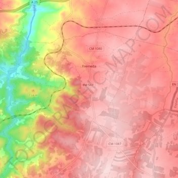
Name: Freineda topographic map, elevation, terrain.
Location: Freineda, Almeida, Guarda, Portugal (40.55081 -6.93402 40.59861 -6.83679)
Average elevation: 758 m
Minimum elevation: 581 m
Maximum elevation: 833 m
Thank you for supporting this site ❤️
Make a donation
Make a donation
Other topographic maps
Click on a map to view its topography, its elevation and its terrain.