
Thank you for supporting this site ❤️
Make a donation
Make a donation
Ua Huka topographic map
Click on the map to display elevation.
Thank you for supporting this site ❤️
Make a donation
Make a donation
About this map
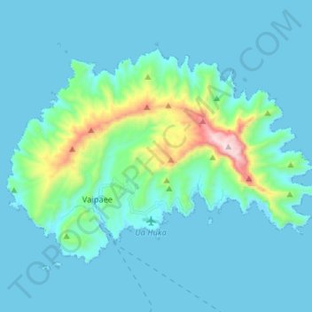
Name: Ua Huka topographic map, elevation, terrain.
Location: Ua Huka, Îles Marquises, Polynésie française, France (-8.95429 -139.61447 -8.86506 -139.48416)
Average elevation: 101 m
Minimum elevation: -1 m
Maximum elevation: 865 m
Thank you for supporting this site ❤️
Make a donation
Make a donation