
Ait Soula topographic map
Interactive map
Click on the map to display elevation.
About this map
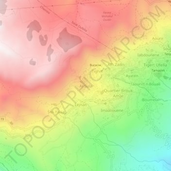
Name: Ait Soula topographic map, elevation, terrain.
Location: Ait Soula, Chemini, Daïra Chemini, Béjaïa, 06770, Algérie (36.57679 4.59237 36.61679 4.63237)
Average elevation: 870 m
Minimum elevation: 257 m
Maximum elevation: 1,344 m