
Thank you for supporting this site ❤️
Make a donation
Make a donation
Verlaine topographic map
Click on the map to display elevation.
Thank you for supporting this site ❤️
Make a donation
Make a donation
About this map
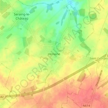
Name: Verlaine topographic map, elevation, terrain.
Location: Verlaine, Huy, Liège, Wallonie, 4537, Belgique (50.58751 5.29844 50.62751 5.33844)
Average elevation: 179 m
Minimum elevation: 149 m
Maximum elevation: 202 m
Thank you for supporting this site ❤️
Make a donation
Make a donation
Other topographic maps
Click on a map to view its topography, its elevation and its terrain.