
Traon Kerret topographic map
Interactive map
Click on the map to display elevation.
About this map
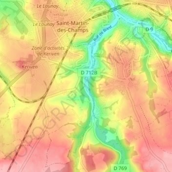
Name: Traon Kerret topographic map, elevation, terrain.
Average elevation: 75 m
Minimum elevation: 6 m
Maximum elevation: 121 m
Other topographic maps
Click on a map to view its topography, its elevation and its terrain.
Kerolzec
France > Bretagne > Finistère > Saint-Martin-des-Champs
Kerolzec, Saint-Martin-des-Champs, Morlaix, Finistère, Bretagne, France métropolitaine, 29600, France
Average elevation: 79 m