
Puerto de Candeleda topographic map
Interactive map
Click on the map to display elevation.
About this map
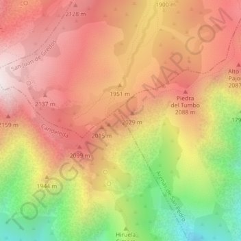
Name: Puerto de Candeleda topographic map, elevation, terrain.
Location: Puerto de Candeleda, Candeleda, Ávila, Castilla y León, España (40.24689 -5.24065 40.24699 -5.24055)
Average elevation: 1,884 m
Minimum elevation: 1,315 m
Maximum elevation: 2,280 m