
Thank you for supporting this site ❤️
Make a donation
Make a donation
Alegrete topographic map
Click on the map to display elevation.
Thank you for supporting this site ❤️
Make a donation
Make a donation
Alegrete
Alegrete is a municipality in Rio Grande do Sul located in southern Brazil. Its medium altitude is 102 m (335 ft). Its estimated population in 2020 was 73,028 inhabitants and the total area is 7,803.967 km2 (3,013.129 sq mi) (the largest municipality of the State and of Southern Brazil). Its inhabitants are called Alegretenses.
Thank you for supporting this site ❤️
Make a donation
Make a donation
About this map
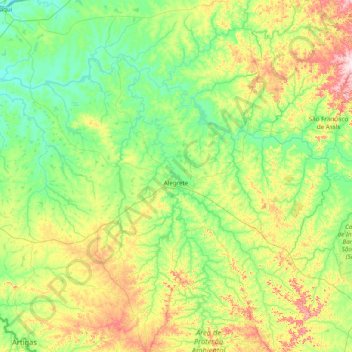
Name: Alegrete topographic map, elevation, terrain.
Average elevation: 131 m
Minimum elevation: 45 m
Maximum elevation: 420 m
Thank you for supporting this site ❤️
Make a donation
Make a donation