
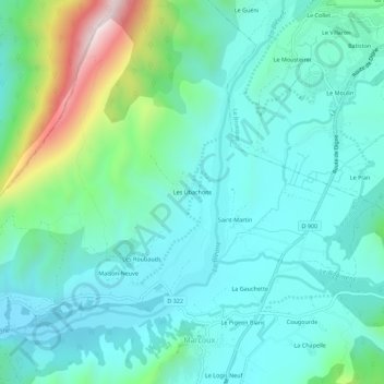
Les Ubachons topographic map
Interactive map
Click on the map to display elevation.
About this map
Name: Les Ubachons topographic map, elevation, terrain.
Average elevation: 777 m
Minimum elevation: 642 m
Maximum elevation: 1,289 m
Other topographic maps
Click on a map to view its topography, its elevation and its terrain.
La Cassette
France > Provence-Alpes-Côte d'Azur > Alpes-de-Haute-Provence > Marcoux
La Cassette, Marcoux, Digne-les-Bains, Alpes-de-Haute-Provence, Provence-Alpes-Côte d'Azur, France métropolitaine, 04420, France
Average elevation: 778 m
Saint-Martin
France > Provence-Alpes-Côte d'Azur > Alpes-de-Haute-Provence > Marcoux > Saint-Martin
Saint-Martin, Marcoux, Digne-les-Bains, Alpes-de-Haute-Provence, Provence-Alpes-Côte d'Azur, France métropolitaine, 04420, France
Average elevation: 771 m