
Muker topographic map
Interactive map
Click on the map to display elevation.
About this map
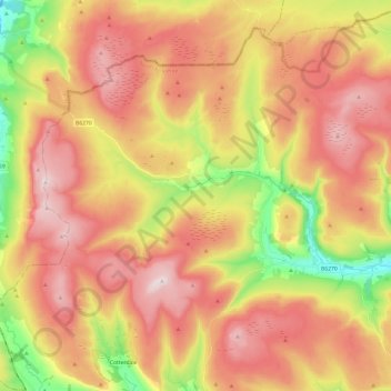
Name: Muker topographic map, elevation, terrain.
Average elevation: 479 m
Minimum elevation: 194 m
Maximum elevation: 714 m
Other topographic maps
Click on a map to view its topography, its elevation and its terrain.
Dalton-on-Tees
Vereinigtes Königreich > England > North Yorkshire > Richmondshire > Dalton-on-Tees
Dalton-on-Tees, Richmondshire, North Yorkshire, Yorkshire and the Humber, England, DL2 2PA, Vereinigtes Königreich
Average elevation: 46 m