
Thank you for supporting this site ❤️
Make a donation
Make a donation
Minas dos Carris topographic map
Click on the map to display elevation.
Thank you for supporting this site ❤️
Make a donation
Make a donation
About this map
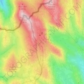
Name: Minas dos Carris topographic map, elevation, terrain.
Location: Minas dos Carris, Cabril, Montalegre, Vila Real, Portugal (41.80199 -8.05518 41.82199 -8.03518)
Average elevation: 1,349 m
Minimum elevation: 1,130 m
Maximum elevation: 1,531 m
Thank you for supporting this site ❤️
Make a donation
Make a donation
Other topographic maps
Click on a map to view its topography, its elevation and its terrain.