
Make a donation
Snoqualmie Pass topographic map
Click on the map to display elevation.
Make a donation
Snoqualmie Pass
Due to its elevation, Snoqualmie Pass experiences significantly lower temperatures than Seattle, and receives much more precipitation, much of it being snow. Snoqualmie Pass has a humid continental climate (Koppen: Dsb bordering Csb) with cold, very wet and snowy winters, and mild to warm, relatively dry summers.
Make a donation
About this map
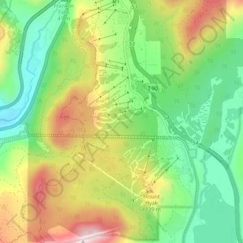
Name: Snoqualmie Pass topographic map, elevation, terrain.
Average elevation: 955 m
Minimum elevation: 625 m
Maximum elevation: 1,498 m
Make a donation
Other topographic maps
Click on a map to view its topography, its elevation and its terrain.
Cathedral Rock
United States > Washington > Kittitas County
Cathedral Rock is an intrusive andesite volcanic complex. The Alpine Lakes Wilderness features some of the most rugged topography in the Cascade Range with craggy peaks and ridges, deep glacial valleys, and granite walls spotted with over 700 mountain lakes. Geological events occurring many years ago created…
Average elevation: 1,547 m
Make a donation
Cathedral Rock
United States > Washington > Kittitas County
Cathedral Rock is an intrusive andesite volcanic complex. The Alpine Lakes Wilderness features some of the most rugged topography in the Cascade Range with craggy peaks and ridges, deep glacial valleys, and granite walls spotted with over 700 mountain lakes. Geological events occurring many years ago created…
Average elevation: 1,547 m