
Schönberger Strand topographic map
Interactive map
Click on the map to display elevation.
About this map
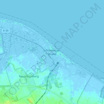
Name: Schönberger Strand topographic map, elevation, terrain.
Average elevation: 1 m
Minimum elevation: -5 m
Maximum elevation: 14 m
Other topographic maps
Click on a map to view its topography, its elevation and its terrain.
24217
Deutschland > Schleswig-Holstein > Plön > Schönberg (Holstein) > Schönberg
24217, Schönberg, Schönberg (Holstein), Probstei, Plön, Schleswig-Holstein, Deutschland
Average elevation: 12 m
Schönberg
Deutschland > Schleswig-Holstein > Plön > Schönberg (Holstein)
Schönberg, Schönberg (Holstein), Probstei, Plön, Schleswig-Holstein, 24217, Deutschland
Average elevation: 16 m