
Thank you for supporting this site ❤️
Make a donation
Make a donation
Oleye topographic map
Click on the map to display elevation.
Thank you for supporting this site ❤️
Make a donation
Make a donation
About this map
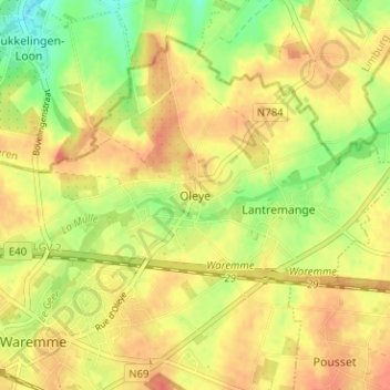
Name: Oleye topographic map, elevation, terrain.
Location: Oleye, Waremme, Liège, Wallonie, 4300, Belgique (50.69271 5.26085 50.73271 5.30085)
Average elevation: 116 m
Minimum elevation: 88 m
Maximum elevation: 134 m
Thank you for supporting this site ❤️
Make a donation
Make a donation
Other topographic maps
Click on a map to view its topography, its elevation and its terrain.