
Mtwara topographic map
Interactive map
Click on the map to display elevation.
About this map
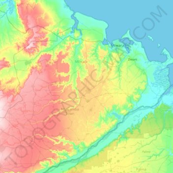
Name: Mtwara topographic map, elevation, terrain.
Location: Mtwara, Coastal Zone, Tanzania (-10.82259 39.62830 -10.12809 40.44539)
Average elevation: 116 m
Minimum elevation: -1 m
Maximum elevation: 348 m
Other topographic maps
Click on a map to view its topography, its elevation and its terrain.