
Thank you for supporting this site ❤️
Make a donation
Make a donation
Illizi topographic map
Click on the map to display elevation.
Thank you for supporting this site ❤️
Make a donation
Make a donation
About this map
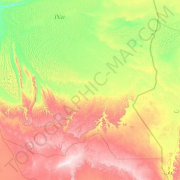
Name: Illizi topographic map, elevation, terrain.
Location: Illizi, Illizi District, Illizi, 33000, Algeria (25.14706 6.13964 27.82948 10.03577)
Average elevation: 774 m
Minimum elevation: 354 m
Maximum elevation: 2,037 m
Thank you for supporting this site ❤️
Make a donation
Make a donation
Other topographic maps
Click on a map to view its topography, its elevation and its terrain.