
Thank you for supporting this site ❤️
Make a donation
Make a donation
Gwespyr topographic map
Click on the map to display elevation.
Thank you for supporting this site ❤️
Make a donation
Make a donation
About this map
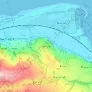
Name: Gwespyr topographic map, elevation, terrain.
Location: Gwespyr, Flintshire, Wales, CH8 9JU, United Kingdom (53.31786 -3.35768 53.35786 -3.31768)
Average elevation: 59 m
Minimum elevation: -2 m
Maximum elevation: 226 m
Thank you for supporting this site ❤️
Make a donation
Make a donation
Other topographic maps
Click on a map to view its topography, its elevation and its terrain.