
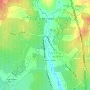
Saint-Caprais-de-Blaye topographic map
Interactive map
Click on the map to display elevation.
About this map
Name: Saint-Caprais-de-Blaye topographic map, elevation, terrain.
Average elevation: 37 m
Minimum elevation: 14 m
Maximum elevation: 66 m
Other topographic maps
Click on a map to view its topography, its elevation and its terrain.
Marcillac
France > Nouvelle-Aquitaine > Gironde > Val-de-Livenne
Marcillac, Val-de-Livenne, Blaye, Gironde, Nouvelle-Aquitaine, France métropolitaine, 33860, France
Average elevation: 44 m
Val-de-Livenne
France > Nouvelle-Aquitaine > Gironde > Val-de-Livenne
Val-de-Livenne, Blaye, Gironde, Nouvelle-Aquitaine, France métropolitaine, 33860, France
Average elevation: 45 m