
Thank you for supporting this site ❤️
Make a donation
Make a donation
Vermelha topographic map
Click on the map to display elevation.
Thank you for supporting this site ❤️
Make a donation
Make a donation
About this map
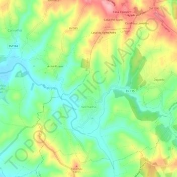
Name: Vermelha topographic map, elevation, terrain.
Location: Vermelha, Cadaval, Lisbon, Portugal (39.25452 -9.12313 39.29522 -9.06538)
Average elevation: 86 m
Minimum elevation: 33 m
Maximum elevation: 165 m
Thank you for supporting this site ❤️
Make a donation
Make a donation
Other topographic maps
Click on a map to view its topography, its elevation and its terrain.