
Thank you for supporting this site ❤️
Make a donation
Make a donation
Zavattarello topographic map
Click on the map to display elevation.
Thank you for supporting this site ❤️
Make a donation
Make a donation
About this map
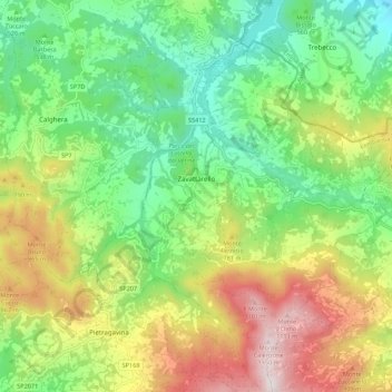
Name: Zavattarello topographic map, elevation, terrain.
Location: Zavattarello, Pavia, Lombardy, 27059, Italy (44.82621 9.23245 44.90390 9.32679)
Average elevation: 625 m
Minimum elevation: 290 m
Maximum elevation: 1,166 m
Thank you for supporting this site ❤️
Make a donation
Make a donation
Other topographic maps
Click on a map to view its topography, its elevation and its terrain.