
Thank you for supporting this site ❤️
Make a donation
Make a donation
Montuïri topographic map
Click on the map to display elevation.
Thank you for supporting this site ❤️
Make a donation
Make a donation
About this map
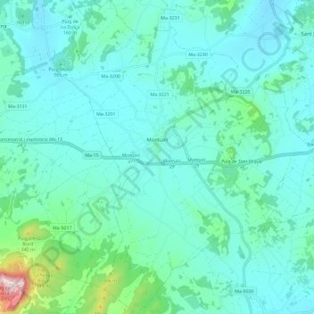
Name: Montuïri topographic map, elevation, terrain.
Location: Montuïri, Pla de Mallorca, Balearische Inseln, Spanien (39.51814 2.94245 39.60636 3.04479)
Average elevation: 168 m
Minimum elevation: 102 m
Maximum elevation: 545 m
Thank you for supporting this site ❤️
Make a donation
Make a donation
Other topographic maps
Click on a map to view its topography, its elevation and its terrain.