
雒容镇 topographic map
Interactive map
Click on the map to display elevation.
About this map
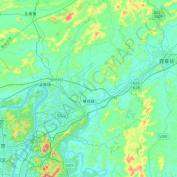
Name: 雒容镇 topographic map, elevation, terrain.
Location: 雒容镇, 柳东新区, 龙婆, 鱼峰区, 柳州市, 广西壮族自治区, 545616, 中国 (24.27406 109.46782 24.58054 109.71050)
Average elevation: 138 m
Minimum elevation: 59 m
Maximum elevation: 531 m