
Thank you for supporting this site ❤️
Make a donation
Make a donation
Teivas topographic map
Click on the map to display elevation.
Thank you for supporting this site ❤️
Make a donation
Make a donation
About this map
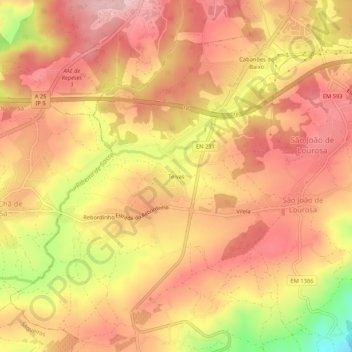
Name: Teivas topographic map, elevation, terrain.
Location: Teivas, São João de Lourosa, Viseu, 3500-883, Portugal (40.59542 -7.94437 40.63542 -7.90437)
Average elevation: 421 m
Minimum elevation: 281 m
Maximum elevation: 492 m
Thank you for supporting this site ❤️
Make a donation
Make a donation