
Thank you for supporting this site ❤️
Make a donation
Make a donation
Ciply topographic map
Click on the map to display elevation.
Thank you for supporting this site ❤️
Make a donation
Make a donation
About this map
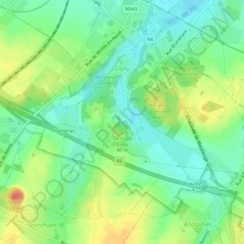
Name: Ciply topographic map, elevation, terrain.
Location: Ciply, Bergen, Henegouwen, Wallonië, 7024, België (50.40322 3.92919 50.42335 3.95888)
Average elevation: 58 m
Minimum elevation: 38 m
Maximum elevation: 90 m
Thank you for supporting this site ❤️
Make a donation
Make a donation
Other topographic maps
Click on a map to view its topography, its elevation and its terrain.