
Thank you for supporting this site ❤️
Make a donation
Make a donation
Labliau topographic map
Click on the map to display elevation.
Thank you for supporting this site ❤️
Make a donation
Make a donation
About this map
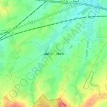
Name: Labliau topographic map, elevation, terrain.
Location: Labliau, Enghien, Ath, Hainaut, Wallonie, 7850, Belgique (50.64639 3.96975 50.68639 4.00975)
Average elevation: 65 m
Minimum elevation: 39 m
Maximum elevation: 116 m
Thank you for supporting this site ❤️
Make a donation
Make a donation
Other topographic maps
Click on a map to view its topography, its elevation and its terrain.