
Thank you for supporting this site ❤️
Make a donation
Make a donation
Edgewood topographic map
Click on the map to display elevation.
Thank you for supporting this site ❤️
Make a donation
Make a donation
About this map
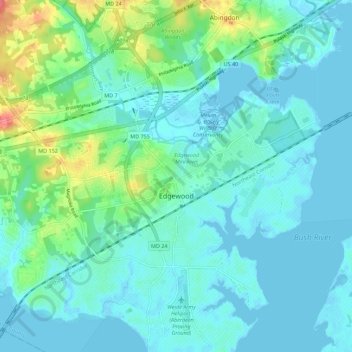
Name: Edgewood topographic map, elevation, terrain.
Location: Edgewood, Harford County, Maryland, United States (39.38041 -76.34871 39.46149 -76.24735)
Average elevation: 12 m
Minimum elevation: -4 m
Maximum elevation: 58 m
Thank you for supporting this site ❤️
Make a donation
Make a donation