
Toul Benalo topographic map
Interactive map
Click on the map to display elevation.
About this map
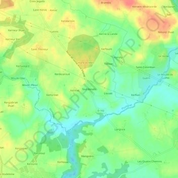
Name: Toul Benalo topographic map, elevation, terrain.
Average elevation: 48 m
Minimum elevation: 22 m
Maximum elevation: 81 m
Other topographic maps
Click on a map to view its topography, its elevation and its terrain.
Coët er Harv
France > Bretagne > Morbihan > Pluvigner
Coët er Harv, Pluvigner, Lorient, Morbihan, Bretagne, France métropolitaine, 56330, France
Average elevation: 68 m
Le Moustoir
France > Bretagne > Morbihan > Pluvigner
Le Moustoir, Pluvigner, Lorient, Morbihan, Bretagne, France métropolitaine, 56330, France
Average elevation: 71 m
Keriagune Saint-Goal
France > Bretagne > Morbihan > Pluvigner
Keriagune Saint-Goal, Pluvigner, Lorient, Morbihan, Bretagne, France métropolitaine, 56330, France
Average elevation: 59 m