
El Moli topographic map
Interactive map
Click on the map to display elevation.
About this map
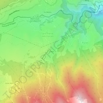
Name: El Moli topographic map, elevation, terrain.
Average elevation: 1,676 m
Minimum elevation: 1,208 m
Maximum elevation: 2,300 m
Other topographic maps
Click on a map to view its topography, its elevation and its terrain.
Pla du Cambre d'Aze
France > Occitanie > Pyrénées-Orientales > Saint-Pierre-dels-Forcats
Pla du Cambre d'Aze, Saint-Pierre-dels-Forcats, Prades, Pyrénées-Orientales, Occitanie, France métropolitaine, 66210, France
Average elevation: 1,989 m