
Thank you for supporting this site ❤️
Make a donation
Make a donation
Llaylla topographic map
Click on the map to display elevation.
Thank you for supporting this site ❤️
Make a donation
Make a donation
About this map
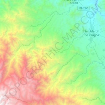
Name: Llaylla topographic map, elevation, terrain.
Location: Llaylla, Province of Satipo, Junín, Peru (-11.61199 -74.76601 -11.34464 -74.52806)
Average elevation: 1,812 m
Minimum elevation: 574 m
Maximum elevation: 4,334 m
Thank you for supporting this site ❤️
Make a donation
Make a donation
Other topographic maps
Click on a map to view its topography, its elevation and its terrain.
Thank you for supporting this site ❤️
Make a donation
Make a donation
Thank you for supporting this site ❤️
Make a donation
Make a donation