
Högsdorf topographic map
Interactive map
Click on the map to display elevation.
About this map
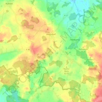
Name: Högsdorf topographic map, elevation, terrain.
Location: Högsdorf, Lütjenburg, Plön, Schleswig-Holstein, Deutschland (54.21598 10.59558 54.27002 10.66342)
Average elevation: 53 m
Minimum elevation: 19 m
Maximum elevation: 89 m