
Glashütten topographic map
Interactive map
Click on the map to display elevation.
About this map
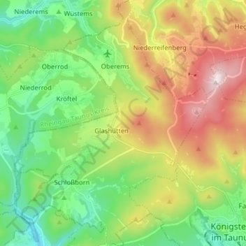
Name: Glashütten topographic map, elevation, terrain.
Location: Glashütten, Hochtaunuskreis, Hesse, 61479, Allemagne (50.17699 8.35225 50.25895 8.45257)
Average elevation: 475 m
Minimum elevation: 246 m
Maximum elevation: 884 m