
Rahier topographic map
Interactive map
Click on the map to display elevation.
About this map
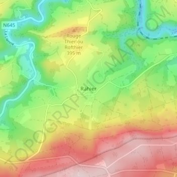
Name: Rahier topographic map, elevation, terrain.
Location: Rahier, Stoumont, Verviers, Luik, Wallonië, 4987, België (50.36592 5.75848 50.40592 5.79848)
Average elevation: 335 m
Minimum elevation: 195 m
Maximum elevation: 498 m