
Thank you for supporting this site ❤️
Make a donation
Make a donation
Poiares topographic map
Click on the map to display elevation.
Thank you for supporting this site ❤️
Make a donation
Make a donation
About this map
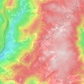
Name: Poiares topographic map, elevation, terrain.
Location: Poiares, Peso da Régua, Vila Real, 5050-434, Portugal (41.15865 -7.74688 41.19865 -7.70688)
Average elevation: 414 m
Minimum elevation: 92 m
Maximum elevation: 580 m
Thank you for supporting this site ❤️
Make a donation
Make a donation
Other topographic maps
Click on a map to view its topography, its elevation and its terrain.