
Thank you for supporting this site ❤️
Make a donation
Make a donation
Ambresin topographic map
Click on the map to display elevation.
Thank you for supporting this site ❤️
Make a donation
Make a donation
About this map
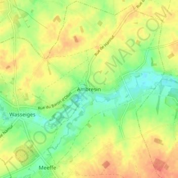
Name: Ambresin topographic map, elevation, terrain.
Location: Ambresin, Wasseiges, Borgworm, Luik, Wallonië, 4219, België (50.60668 5.01051 50.64668 5.05051)
Average elevation: 142 m
Minimum elevation: 120 m
Maximum elevation: 162 m
Thank you for supporting this site ❤️
Make a donation
Make a donation
Other topographic maps
Click on a map to view its topography, its elevation and its terrain.
Thank you for supporting this site ❤️
Make a donation
Make a donation
Thank you for supporting this site ❤️
Make a donation
Make a donation
Thank you for supporting this site ❤️
Make a donation
Make a donation