
Ontonagon County topographic map
Interactive map
Click on the map to display elevation.
About this map
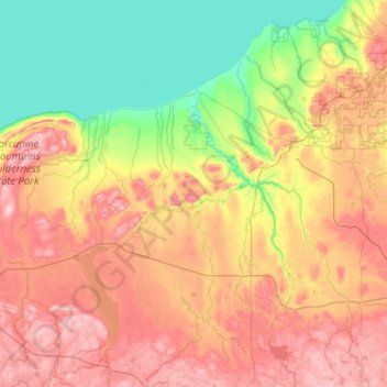
Name: Ontonagon County topographic map, elevation, terrain.
Location: Ontonagon County, Michigan, USA (46.33038 -89.88539 47.02891 -88.86374)
Average elevation: 335 m
Minimum elevation: 175 m
Maximum elevation: 587 m
Other topographic maps
Click on a map to view its topography, its elevation and its terrain.
Isle Royale National Park
Isle Royale National Park, Greenstone Ridge Trail, Houghton Township, Keweenaw County, Michigan, USA
Average elevation: 189 m