
Amazonas topographic map
Interactive map
Click on the map to display elevation.
Amazonas
The relief of the state is relatively low, since in the region, 85% does not surpass 100 metres (330 ft) of altitude. The highest points of the state are the Pico da Neblina, with an approximate height of 2,994 metres (9,823 ft), followed by Pico Phelps or Pico 31 of March of 2,973 metres (9,754 ft), located in the border between Venezuela and Brazil, both mountains are in the municipality of Santa Isabel do Rio Negro and ironically, are the highest in Brazil.
About this map
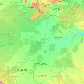
Name: Amazonas topographic map, elevation, terrain.
Location: Amazonas, North Region, Brazil (-9.81805 -73.79842 2.23011 -56.09700)
Average elevation: 179 m
Minimum elevation: 0 m
Maximum elevation: 3,861 m
Other topographic maps
Click on a map to view its topography, its elevation and its terrain.
Atlantic Forest
Brazil > São Paulo > Região Metropolitana de São Paulo > Ribeirão Pires
Average elevation: 787 m