
Thank you for supporting this site ❤️
Make a donation
Make a donation
Pralungo topographic map
Click on the map to display elevation.
Thank you for supporting this site ❤️
Make a donation
Make a donation
About this map
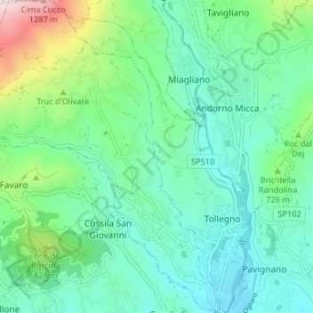
Name: Pralungo topographic map, elevation, terrain.
Location: Pralungo, Biella, Piedmont, 13899, Italy (45.57924 7.99808 45.62508 8.05068)
Average elevation: 633 m
Minimum elevation: 417 m
Maximum elevation: 1,360 m
Thank you for supporting this site ❤️
Make a donation
Make a donation
Other topographic maps
Click on a map to view its topography, its elevation and its terrain.
Thank you for supporting this site ❤️
Make a donation
Make a donation
Thank you for supporting this site ❤️
Make a donation
Make a donation
Thank you for supporting this site ❤️
Make a donation
Make a donation
Thank you for supporting this site ❤️
Make a donation
Make a donation
Thank you for supporting this site ❤️
Make a donation
Make a donation