
Maa topographic map
Interactive map
Click on the map to display elevation.
About this map
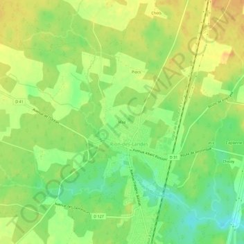
Name: Maa topographic map, elevation, terrain.
Average elevation: 73 m
Minimum elevation: 53 m
Maximum elevation: 88 m
Other topographic maps
Click on a map to view its topography, its elevation and its terrain.
Rion-des-Landes
France > Nouvelle-Aquitaine > Landes > Rion-des-Landes
Rion-des-Landes, Dax, Landes, Nouvelle-Aquitaine, France métropolitaine, 40370, France
Average elevation: 77 m
Rion-des-Landes
France > Nouvelle-Aquitaine > Landes > Rion-des-Landes
Rion-des-Landes, Arrondissement de Dax, Landes, Nouvelle-Aquitaine, France métropolitaine, 40370, France
Average elevation: 75 m