
老虎滩街道 topographic map
Interactive map
Click on the map to display elevation.
About this map
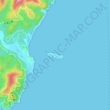
Name: 老虎滩街道 topographic map, elevation, terrain.
Location: 老虎滩街道, 中山区, 辽宁省, 中国, 棒棰岛 (38.88305 121.71085 38.88546 121.71681)
Average elevation: 15 m
Minimum elevation: -2 m
Maximum elevation: 147 m