
Les Fades topographic map
Interactive map
Click on the map to display elevation.
About this map
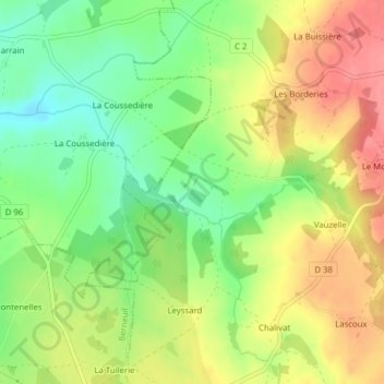
Name: Les Fades topographic map, elevation, terrain.
Average elevation: 301 m
Minimum elevation: 264 m
Maximum elevation: 338 m
Other topographic maps
Click on a map to view its topography, its elevation and its terrain.
Laubard
France > Nouvelle-Aquitaine > Haute-Vienne > Saint-Pardoux-le-Lac > Roussac > Laubard
Laubard, Roussac, Saint-Pardoux-le-Lac, Bellac, Haute-Vienne, Nouvelle-Aquitaine, France métropolitaine, 87140, France
Average elevation: 330 m