
Champéry topographic map
Interactive map
Click on the map to display elevation.
About this map
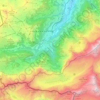
Name: Champéry topographic map, elevation, terrain.
Location: Champéry, Monthey, Wallis, 1874, Schweiz (46.12927 6.79029 46.19007 6.91014)
Average elevation: 1,883 m
Minimum elevation: 820 m
Maximum elevation: 3,251 m
Other topographic maps
Click on a map to view its topography, its elevation and its terrain.
Les Cornettes de Bise
Schweiz > Wallis > Monthey > Vouvry
Les Cornettes de Bise, Vouvry, Monthey, Wallis, 1896, Schweiz
Average elevation: 1,904 m