
North Walpole topographic map
Interactive map
Click on the map to display elevation.
About this map
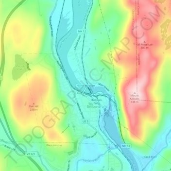
Name: North Walpole topographic map, elevation, terrain.
Average elevation: 168 m
Minimum elevation: 65 m
Maximum elevation: 329 m
Other topographic maps
Click on a map to view its topography, its elevation and its terrain.
Drewsville
United States > New Hampshire > Cheshire County > Walpole
Drewsville, Walpole, Cheshire County, New Hampshire, 03604, United States
Average elevation: 182 m