
Thank you for supporting this site ❤️
Make a donation
Make a donation
Skyline View topographic map
Click on the map to display elevation.
Thank you for supporting this site ❤️
Make a donation
Make a donation
About this map
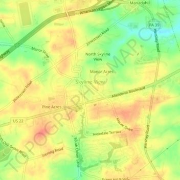
Name: Skyline View topographic map, elevation, terrain.
Average elevation: 152 m
Minimum elevation: 123 m
Maximum elevation: 170 m
Thank you for supporting this site ❤️
Make a donation
Make a donation
Other topographic maps
Click on a map to view its topography, its elevation and its terrain.
Piketown
United States > Pennsylvania > Dauphin County > West Hanover Township
Average elevation: 195 m
Hanoverdale
United States > Pennsylvania > Dauphin County > West Hanover Township
Average elevation: 143 m