
Lewiston topographic map
Interactive map
Click on the map to display elevation.
About this map
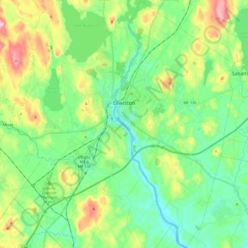
Name: Lewiston topographic map, elevation, terrain.
Average elevation: 86 m
Minimum elevation: 30 m
Maximum elevation: 212 m
Other topographic maps
Click on a map to view its topography, its elevation and its terrain.
Poland
États-Unis d'Amérique > Maine > Androscoggin County
Poland, Androscoggin County, Maine, 04274, États-Unis d'Amérique
Average elevation: 119 m