
Lat Krabang District topographic map
Interactive map
Click on the map to display elevation.
About this map
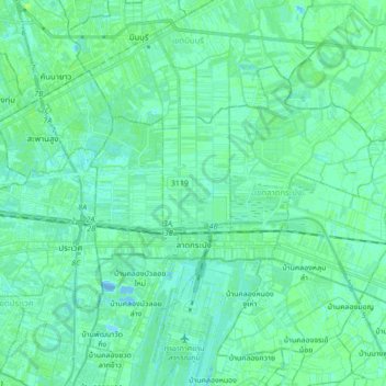
Name: Lat Krabang District topographic map, elevation, terrain.
Location: Lat Krabang District, Bangkok, 10520, Thailand (13.68944 100.70660 13.80041 100.87894)
Average elevation: 3 m
Minimum elevation: -11 m
Maximum elevation: 8 m
Other topographic maps
Click on a map to view its topography, its elevation and its terrain.
Bangkok
Bangkok is in the Chao Phraya River delta in Thailand's central plain. The river meanders through the city in a southerly direction, emptying into the Gulf of Thailand approximately 25 kilometres (16 mi) south of city centre. The area is flat and low-lying, with an average elevation of 1.5 metres (4 ft 11 in)…
Average elevation: 4 m