
剑川县 topographic map
Interactive map
Click on the map to display elevation.
About this map
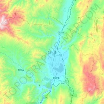
Name: 剑川县 topographic map, elevation, terrain.
Location: 剑川县, 大理白族自治州, 云南省, 中国 (26.38006 99.74459 26.70006 100.06459)
Average elevation: 2,722 m
Minimum elevation: 2,176 m
Maximum elevation: 4,121 m
剑川县最高点是雪斑山主峰,海拔4,295米,最低点为沙溪米子坪,海拔1,973米,县城海拔2,195米。
Other topographic maps
Click on a map to view its topography, its elevation and its terrain.