
Thank you for supporting this site ❤️
Make a donation
Make a donation
Hainhofen topographic map
Click on the map to display elevation.
Thank you for supporting this site ❤️
Make a donation
Make a donation
About this map
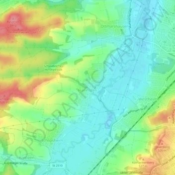
Name: Hainhofen topographic map, elevation, terrain.
Location: Hainhofen, Neusäß, Landkreis Augsburg, Bayern, Deutschland (48.37914 10.75748 48.39486 10.80822)
Average elevation: 486 m
Minimum elevation: 454 m
Maximum elevation: 544 m
Thank you for supporting this site ❤️
Make a donation
Make a donation