
Thank you for supporting this site ❤️
Make a donation
Make a donation
Pals topographic map
Click on the map to display elevation.
Thank you for supporting this site ❤️
Make a donation
Make a donation
About this map
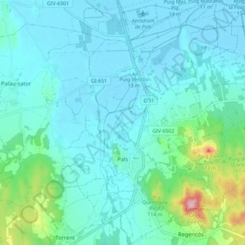
Name: Pals topographic map, elevation, terrain.
Location: Pals, Niederampurien, Girona, Katalonien, 17256, Spanien (41.94975 3.13471 42.01050 3.20749)
Average elevation: 33 m
Minimum elevation: -3 m
Maximum elevation: 212 m
Thank you for supporting this site ❤️
Make a donation
Make a donation
Other topographic maps
Click on a map to view its topography, its elevation and its terrain.