
Westover topographic map
Interactive map
Click on the map to display elevation.
About this map
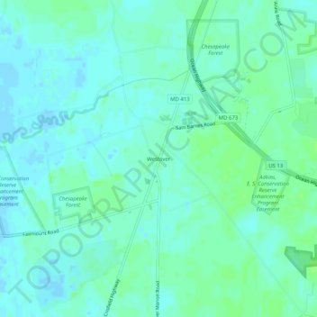
Name: Westover topographic map, elevation, terrain.
Location: Westover, Somerset County, Maryland, 21890, United States (38.10401 -75.72632 38.14401 -75.68632)
Average elevation: 4 m
Minimum elevation: -3 m
Maximum elevation: 8 m
Other topographic maps
Click on a map to view its topography, its elevation and its terrain.
Princess Anne
United States > Maryland > Somerset County
Princess Anne, Somerset County, Maryland, 21853, United States
Average elevation: 5 m
Smith Island
United States > Maryland > Somerset County > Tylerton
Smith Island, Tylerton, Somerset County, Maryland, United States
Average elevation: 0 m
Eden
United States > Maryland > Somerset County
Eden, Somerset County, Maryland, 21822, United States
Average elevation: 8 m
Marion
United States > Maryland > Somerset County
Marion, Somerset County, Maryland, 21838, United States
Average elevation: 2 m
Crisfield
United States > Maryland > Somerset County
Crisfield, Somerset County, Maryland, 21817, United States
Average elevation: 1 m