
Thank you for supporting this site ❤️
Make a donation
Make a donation
Heusden-Zolder topographic map
Click on the map to display elevation.
Thank you for supporting this site ❤️
Make a donation
Make a donation
About this map
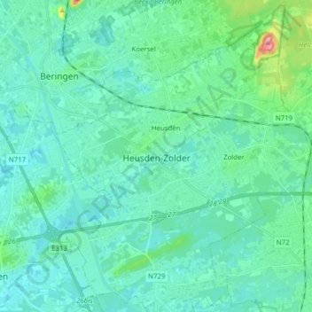
Name: Heusden-Zolder topographic map, elevation, terrain.
Location: Heusden-Zolder, Hasselt, Limburg, Flanders, 3550, Belgium (50.97518 5.22428 51.07267 5.35195)
Average elevation: 38 m
Minimum elevation: 19 m
Maximum elevation: 142 m
Thank you for supporting this site ❤️
Make a donation
Make a donation