
Thank you for supporting this site ❤️
Make a donation
Make a donation
Elko topographic map
Click on the map to display elevation.
Thank you for supporting this site ❤️
Make a donation
Make a donation
About this map
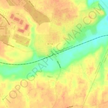
Name: Elko topographic map, elevation, terrain.
Location: Elko, Henrico County, Virginia, United States (37.45292 -77.23136 37.49292 -77.19136)
Average elevation: 36 m
Minimum elevation: 7 m
Maximum elevation: 52 m
Thank you for supporting this site ❤️
Make a donation
Make a donation
Other topographic maps
Click on a map to view its topography, its elevation and its terrain.
Canterbury Lake
United States > Virginia > Henrico County > Tuckahoe > Canterbury
Average elevation: 58 m
Canterbury Dam
United States > Virginia > Henrico County > Tuckahoe > Canterbury
Average elevation: 57 m
Thank you for supporting this site ❤️
Make a donation
Make a donation